Perdeu a senha?
Novo usuário? Criar uma conta
Big eye, Philippines. Photo by Stephane Rochon.
Aprecie e contribua!
| Achar os melhores sites |
|
|
![]() South Korea
South Korea
Ásia
Localização: Eastern Asia, southern half of the Korean Peninsula bordering the Sea of Japan and the Yellow Sea
Coordenadas geográficas: 38° 30' N, 127° 9' E
Costa: 2,413 km km
Clima: temperate, with rainfall heavier in summer than winter
Relevo: mostly hills and mountains; wide coastal plains in west and south
Cimeiras:
Riscos naturais: occasional typhoons bring high winds and floods; low-level seismic activity common in southwest
Moeda: South Korean won (KRW)
População:
Línguas: Korean
Capital:
Divisão administrativa:
Mais informações
| Jan | Feb | Mar | Apr | May | Jun | Jul | Aug | Sep | Oct | Nov | Dec | |
|---|---|---|---|---|---|---|---|---|---|---|---|---|
| Climate | ||||||||||||
| Air temp. | ||||||||||||
| Water temp. | ||||||||||||
| Equipment | ||||||||||||
| Best season | ||||||||||||
Você quer acrescentar outras informações sobre South Korea? Diga-nos...
Este mapa é interactivo! Use os controles para fazer zoom ou para se deslocar.
- mergulhos (0)
- viagens (0)
- Fotos (20)
- Vídeos (0)
- Compartilhe
- Favoritos
-
Os seus sítios favoritos e as futuras listas de spots
Sites de mergulho
| Sites de mergulho (7) | Qualidade | Profundidade média | Profundidade máxima | Experiência | Tipo de mergulho | ||
|---|---|---|---|---|---|---|---|
| Flower garden | 3 / - | 20 m | 23 m | CMAS ** / AOW | 
|
||
| Gijam | 3 / - | 10 m | 13 m | Para todos os níveis |
|
||
| Jeju Moon-Island | 5 / - | 15 m | 25 m | Para todos os níveis | 
|
||
| Nagok sunken vessel No1 | 2 / - | 18 m | 22 m | CMAS ** / AOW | 
|
||
| Nagok sunken vessel No2 | 3 / - | 22 m | 25 m | CMAS ** / AOW |
|
||
| Nagok Wreck | 3 / - | 20 m | 24 m | CMAS ** / AOW |
|
||
| Sungsunaegi | 1 / - | 19 m | 22 m | CMAS ** / AOW |
|
 Fotos
Fotos
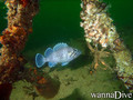
Buk-myeon Wreck |
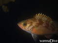
Buk-myeon Wreck |
Buk-myeon Wreck |

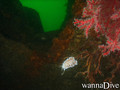
Flower garden |
Comentários
Seja o(a) primeiro(a) a fazer um comentário sobre este país
Erros, Reacções
Se você quer adicionar novas informações ou se você encontrou erros nesta página, Envie as suas observações