Perdeu a senha?
Novo usuário? Criar uma conta
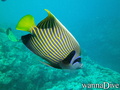
Big eye, Philippines. Photo by Stephane Rochon.
Aprecie e contribua!
| Achar os melhores sites |
|
|
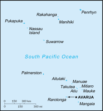
 Cook Islands
Austrália e Pacífico
Localização: Oceania, group of islands in the South Pacific Ocean, about one-half of the way from Hawaii to New Zealand
Coordenadas geográficas: 21° 14' S, 159° 46' W
Costa: 120 km km
Clima: tropical oceanic; moderated by trade winds; a dry season from April to November and a more humid season from December to March
Relevo: low coral atolls in north; volcanic, hilly islands in south
Cimeiras: lowest point: Pacific Ocean 0 m
highest point: Te Manga 652 m
Riscos naturais: typhoons (November to March)
Moeda: NZ dollar (NZD)
População: 21,750 (July 2007 est.)
Línguas: English (official), Maori
Capital: Avarua
Divisão administrativa:
Mais informações
| Jan | Feb | Mar | Apr | May | Jun | Jul | Aug | Sep | Oct | Nov | Dec | |
|---|---|---|---|---|---|---|---|---|---|---|---|---|
| Climate | ||||||||||||
| Air temp. | ||||||||||||
| Water temp. | ||||||||||||
| Equipment | Don't know | Don't know | Don't know | Don't know | Don't know | Don't know | Don't know | Don't know | Don't know | Don't know | Don't know | Don't know |
| Best season | ||||||||||||
Mapa
Você quer acrescentar outras informações sobre Cook Islands? Diga-nos...
Este mapa é interactivo! Use os controles para fazer zoom ou para se deslocar.
- mergulhos (0)
- viagens (0)
- Fotos (36)
- Vídeos (0)
- Compartilhe
- Favoritos
-
Os seus sítios favoritos e as futuras listas de spots
A sua zona preferida não está na lista? Acrescentar uma zona
zonas
| zonas (2) | Sites de mergulho | Sub-zonas |
|---|---|---|
| Aitutaki | 1 | 0 |
| Rarotonga | 4 | 0 |
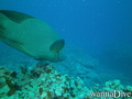
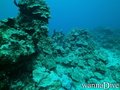
 Fotos
Fotos
Aruntanga Passage |
Aruntanga Passage |
Aruntanga Passage |
Alberto s |
Comentários
Erros, Reacções
Se você quer adicionar novas informações ou se você encontrou erros nesta página, Envie as suas observações