Perdeu a senha?
Novo usuário? Criar uma conta
Lizard fish, Philippines. Photo by Stephane Rochon.
Aprecie e contribua!
| Achar os melhores sites |
|
|
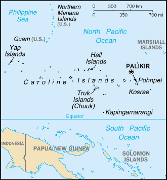
 Federal State of Micronesia
Austrália e Pacífico
Localização: Oceania, island group in the North Pacific Ocean, about three-quarters of the way from Hawaii to Indonesia.
Coordenadas geográficas: 6° 33' N, 158° 9' E
Costa: 6,112 km km
Clima: tropical; heavy year-round rainfall, especially in the eastern islands; located on southern edge of the typhoon belt with occasionally severe damage
Relevo: islands vary geologically from high mountainous islands to low, coral atolls; volcanic outcroppings on Pohnpei, Kosrae, and Chuuk
Cimeiras: highest point: Dolohmwar (Totolom) 791 m
Riscos naturais: typhoons (June to December)
Moeda: US dollar (USD)
População: 108,105 (July 2005 est.)
Línguas: English (official and common language), Trukese, Pohnpeian, Yapese, Kosrean, Ulithian, Woleaian, Nukuoro, Kapingamarangi
Capital: Palikir
Divisão administrativa: 4 states; Chuuk (Truk), Kosrae (Kosaie), Pohnpei (Ponape), Yap
Mais informações
| Jan | Feb | Mar | Apr | May | Jun | Jul | Aug | Sep | Oct | Nov | Dec | |
|---|---|---|---|---|---|---|---|---|---|---|---|---|
| Climate | ||||||||||||
| Air temp. | ||||||||||||
| Water temp. | ||||||||||||
| Equipment | ||||||||||||
| Best season | ||||||||||||
Mapa
Você quer acrescentar outras informações sobre Federal State of Micronesia? Diga-nos...
Este mapa é interactivo! Use os controles para fazer zoom ou para se deslocar.
- mergulhos (5)
- viagens (0)
- Fotos (80)
- Vídeos (1)
- Compartilhe
- Favoritos
-
Os seus sítios favoritos e as futuras listas de spots
A sua zona preferida não está na lista? Acrescentar uma zona
zonas
| zonas (5) | Sites de mergulho | Sub-zonas |
|---|---|---|
| Guam | 7 | 0 |
| Kosrae | 1 | 0 |
| Pohnpei | 10 | 0 |
| Truk Lagoon | 16 | 0 |
| Yap | 20 | 0 |
Sites de mergulho
| Sites de mergulho (2) | Qualidade | Profundidade média | Profundidade máxima | Experiência | Tipo de mergulho | ||
|---|---|---|---|---|---|---|---|
| Lelu Aeroplane | - / - | 20 m | 35 m | CMAS * / OW | 

|
||
| Lelu Wrecks | - / - | 18 m | 30 m | CMAS * / OW |
|
 Fotos
Fotos
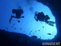
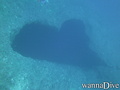
Blue hole |
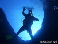
Blue hole |
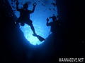
Blue hole |
Blue hole |
Últimos mergulhos
|
Comentários
Erros, Reacções
Se você quer adicionar novas informações ou se você encontrou erros nesta página, Envie as suas observações