Perdeu a senha?
Novo usuário? Criar uma conta
Whale Shark, Philippines. Photo by Stephane Rochon.
Aprecie e contribua!
| Achar os melhores sites |
|
|
 Saint Thomas Island
Virgin Islands
English (Traduzir este texto em Português): Saint Thomas is part of the United States Virgin Islands (USVI), an unincorporated territory of the United States. Located on the island is the territorial capital and port of Charlotte Amalie. As of the 2000 census, the population of Saint Thomas was 51,181, about 47 percent of the U.S. Virgin Islands total. The district has a land area of 80.9 km² (31.24 sq mi). Source: Wikipedia.org
Mais informações
| Jan | Feb | Mar | Apr | May | Jun | Jul | Aug | Sep | Oct | Nov | Dec | |
|---|---|---|---|---|---|---|---|---|---|---|---|---|
| Climate | ||||||||||||
| Air temp. | ||||||||||||
| Water temp. | ||||||||||||
| Equipment | Je ne sais pas | Je ne sais pas | Je ne sais pas | Je ne sais pas | Je ne sais pas | Je ne sais pas | Je ne sais pas | Je ne sais pas | Je ne sais pas | Je ne sais pas | Je ne sais pas | Je ne sais pas |
| Best season | ||||||||||||
Este mapa é interactivo! Use os controles para fazer zoom ou para se deslocar.
- mergulhos (2)
- viagens (1)
- Fotos (18)
- Vídeos (0)
- Compartilhe
- Favoritos
-
Os seus sítios favoritos e as futuras listas de spots
Sites de mergulho
| Sites de mergulho (19) | Qualidade | Profundidade média | Profundidade máxima | Experiência | Tipo de mergulho | ||
|---|---|---|---|---|---|---|---|
| Arches and Tunnels | 2 / - | 9.1 m | 15.2 m | Para todos os níveis | 
|
||
| Calf Rock | - / - | 12 m | 14 m | Para todos os níveis |
|
||
| Cartanza Señor Wreck | 4 / - | 21.3 m | 24.4 m | CMAS ** / AOW | 
|
||
| Christmas Cove | - / - | 8 m | 12 m | Para todos os níveis | 
|
||
| Coki Beach | 9 / - | 8 m | 15 m | Para todos os níveis |
|
||
| Cow Rock | - / - | 12 m | 15 m | Para todos os níveis |
|
||
| Dive Flag Rock | - / - | 15.2 m | 19.8 m | Para todos os níveis | 
|
||
| French Cap | - / - | 27.4 m | 30.5 m | CMAS ** / AOW | 
|
||
| General Rogers Wreck | - / - | 18.3 m | 21.3 m | Para todos os níveis |
|
||
| Ledges of Little Saint James | - / - | 9.8 m | 15.2 m | Para todos os níveis |
|
||
| Magens bay | - / - | 6 m | 8 m | Para todos os níveis |
|
||
| Miss Opportunity Wreck | - / - | 22.9 m | 25.9 m | CMAS * / OW |
|
||
| Navy Barges | - / - | 10.7 m | 12.2 m | Para todos os níveis |
|
||
| Saba Island | - / - | 12.2 m | 18.3 m | CMAS * / OW |
|
||
| Secret Harbour | - / - | 4.6 m | 4.6 m | Para todos os níveis |
|
||
| Sprat | 3 / - | 9.8 m | 18.3 m | Para todos os níveis |
|
||
| Stragglers Rocks | - / - | 12 m | 15 m | Para todos os níveis |
|
||
| WIT Concrete Wreck | - / - | 21.9 m | 31.1 m | CMAS * / OW |

|
||
| WIT Shoal Wreck | - / - | 22.9 m | 27.4 m | CMAS ** / AOW |
|
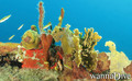
 Fotos
Fotos

Arches and Tunnels |

Cartanza Senor Wreck |

Cartanza Senor Wreck |
Cartanza Senor Wreck |
Últimos mergulhos
|
Comentários
Seja o(a) primeiro(a) a fazer um comentário sobre este país
Erros, Reacções
Você pode editar esta página para corrigir os erros e acrescentar novas informações. Se você tem outros comentários sobre esta página, Envie as suas observações