Perdeu a senha?
Novo usuário? Criar uma conta
Big eye, Philippines. Photo by Stephane Rochon.
Aprecie e contribua!
| Achar os melhores sites |
|
|
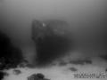
 Imperial Eagle MV
Malta, Malta island
Este mapa é interactivo! Use os controles para fazer zoom ou para se deslocar.
|
Datum: WGS84 [ Auxílio ] |
Latitude: 35° 57.096' N |
Notação (1)
- Favoritos
-
Os seus sítios favoritos e as futuras listas de spots
Acesso
|
Como? De barco Distância Bom trajecto por barco (< 30min) Fácil de encontrar? Fácil de encontrar |
Características do local
Outro nome Imperial Eagle ferry
Profundidade média 35 m / 114.8 ft
Profundidade máxima 46 m / 150.9 ft
Correnteza Fraco ( < 1 nó)
Visibilidade Boa ( 10 - 30 m)
Qualidade
Qualidade do sitio Excelente
Experiência CMAS ** / AOW
Interesse bio Interessante
Mais detalhes
Cheio durante a semana
Cheio no fim de semana
Tipo de mergulho
- Escombros de naufrágio
Actividades de mergulho
- Formação
- Fotografia
Perigos
- Profundidade
Informações suplementares
English (Traduzir este texto em Português): The Imperial Eagle was one of the ferryboats connecting Malta and Gozo.
The hull, in navigation trim, lays on a sandy bottom at a depth of -42m, 300m North-East of Qwara Point.
Autor: Vladimir Dunaev Contribuintes (1) Eles mergulharam neste spot! (6)
 Fotos
Fotos

Imperial Eagle MV |

Imperial Eagle MV |

Imperial Eagle MV |
Imperial Eagle MV |
Comentários
Seja o(a) primeiro(a) a fazer um comentário sobre este país
Erros, Reacções
Você pode editar esta página para corrigir os erros e acrescentar novas informações. Se você tem outros comentários sobre esta página, Envie as suas observações